Benthic Invertebrate Mapping Anna Plains and Roebuck Bay
Since 1997, in 3-10 year intervals, we map the benthic animals of the northern mudflats of Roebuck Bay and Eighty Mile Beach in NW Australia. In both areas we sample on a 200 m grid. At Roebuck Bay that amounts to >500 samplings stations; at Eighty Mile Beach, we sample >816 stations along ca. 75 km of beach.
The work is coordinated by Grant Pearson, Bob Hickey, Marc Lavaleye, Petra de Goeij and Theunis Piersma and their teams. In reference to the 2016 expedition, Andrew Storey was pivotal in the funding, direction, liaison with the funding agency and management of the published outcomes of AnnRoeBIM16. Andrew Storey also has involvement in independent research on nutrients sources in Roebuck Bay that complements the macrobenthic work. See below for download links to expedition publications.
[caption id="attachment_2813" align="alignnone" width="1920"]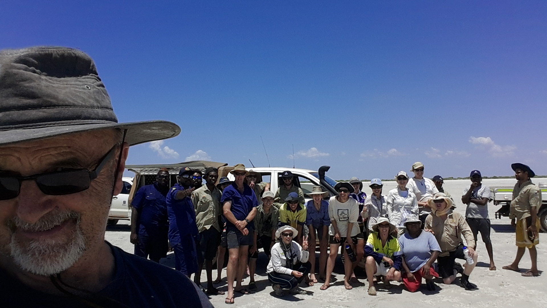 Grant Pearson, coordinator of Anna Plains and Roebuck Bay Benthic Invertebrate Mapping (AnnRoeBIM) and part of his team at Eighty Mile Beach. Photo: Grant Pearson[/caption]
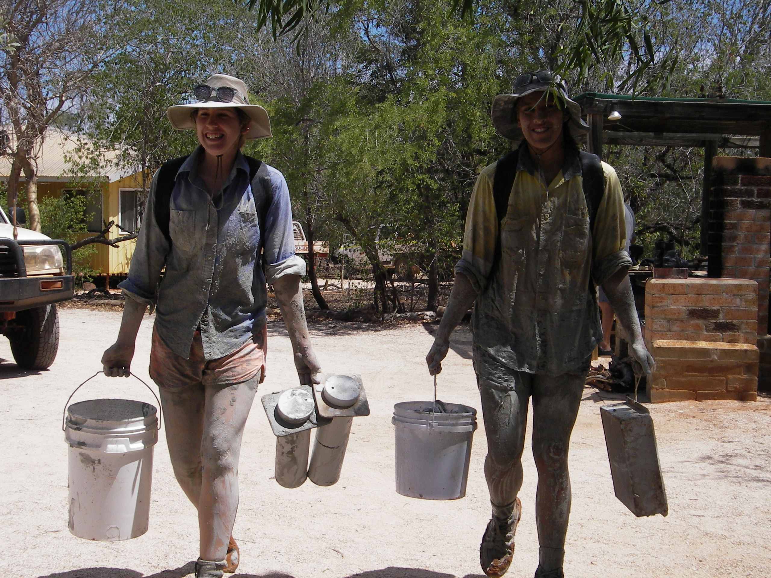 (Happy) samplers returning from in Roebuck Bay. Photo: Yvonne Winchcombe[/caption]
Hundreds of thousands of migratory shorebirds rely on Roebuck Bay and Eighty Mile Beach for their non-breeding survival and preparation for northward migration. Indeed, there are few places on earth where intertidal mudflats support larger numbers of migratory shorebirds.
[caption id="attachment_2751" align="alignnone" width="2048"]
(Happy) samplers returning from in Roebuck Bay. Photo: Yvonne Winchcombe[/caption]
Hundreds of thousands of migratory shorebirds rely on Roebuck Bay and Eighty Mile Beach for their non-breeding survival and preparation for northward migration. Indeed, there are few places on earth where intertidal mudflats support larger numbers of migratory shorebirds.
[caption id="attachment_2751" align="alignnone" width="2048"]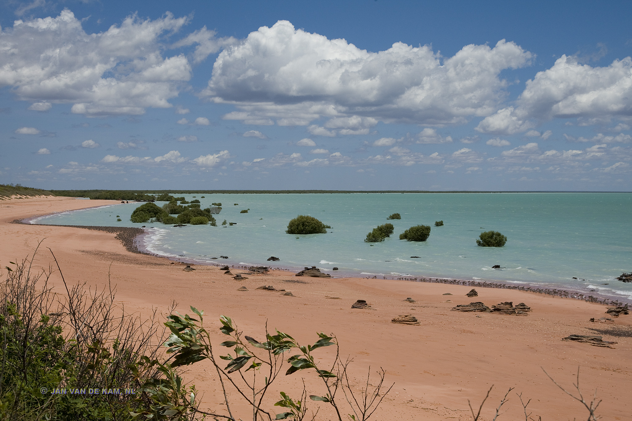 Roebuck Bay, Broome. Western Australia[/caption]
Roebuck Bay is one of fewer than twenty comparable coastal areas scattered around the globe. The features that characterise this Bay and make it so outstanding are varied and complex have also been the subject of considerable scientific and community investigation over the past 20 years. This unusual collaboration between science and community has been the catalyst for ours effort to map the nature and distribution of the sediments of Roebuck Bay and Eighty Mile Beach.
[caption id="attachment_2762" align="alignnone" width="1024"]
Roebuck Bay, Broome. Western Australia[/caption]
Roebuck Bay is one of fewer than twenty comparable coastal areas scattered around the globe. The features that characterise this Bay and make it so outstanding are varied and complex have also been the subject of considerable scientific and community investigation over the past 20 years. This unusual collaboration between science and community has been the catalyst for ours effort to map the nature and distribution of the sediments of Roebuck Bay and Eighty Mile Beach.
[caption id="attachment_2762" align="alignnone" width="1024"]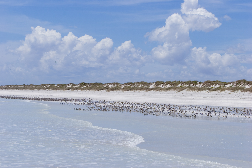 Eighty Mile Beach. Photo: Jan van de Kam[/caption]
Shorebirds have been surveyed a number of times since Eighty Mile Beach was ‘discovered’ by shorebird biologists in 1981, and some variably complete shorebird counts were carried out in the early 1980’s by a combination of aerial survey and localised ground counts. The first complete ground-based summer count of the shorebirds was carried out in 1999. Subsequent surveys confirmed the great importance of Eighty Mile Beach to shorebirds and revealed that most species are quite consistent in their distribution on the beach, with many species occurring in highest numbers in the section between 0 and 65 km south of the Anna Plains access point.
[caption id="attachment_2797" align="alignnone" width="2560"]
Eighty Mile Beach. Photo: Jan van de Kam[/caption]
Shorebirds have been surveyed a number of times since Eighty Mile Beach was ‘discovered’ by shorebird biologists in 1981, and some variably complete shorebird counts were carried out in the early 1980’s by a combination of aerial survey and localised ground counts. The first complete ground-based summer count of the shorebirds was carried out in 1999. Subsequent surveys confirmed the great importance of Eighty Mile Beach to shorebirds and revealed that most species are quite consistent in their distribution on the beach, with many species occurring in highest numbers in the section between 0 and 65 km south of the Anna Plains access point.
[caption id="attachment_2797" align="alignnone" width="2560"]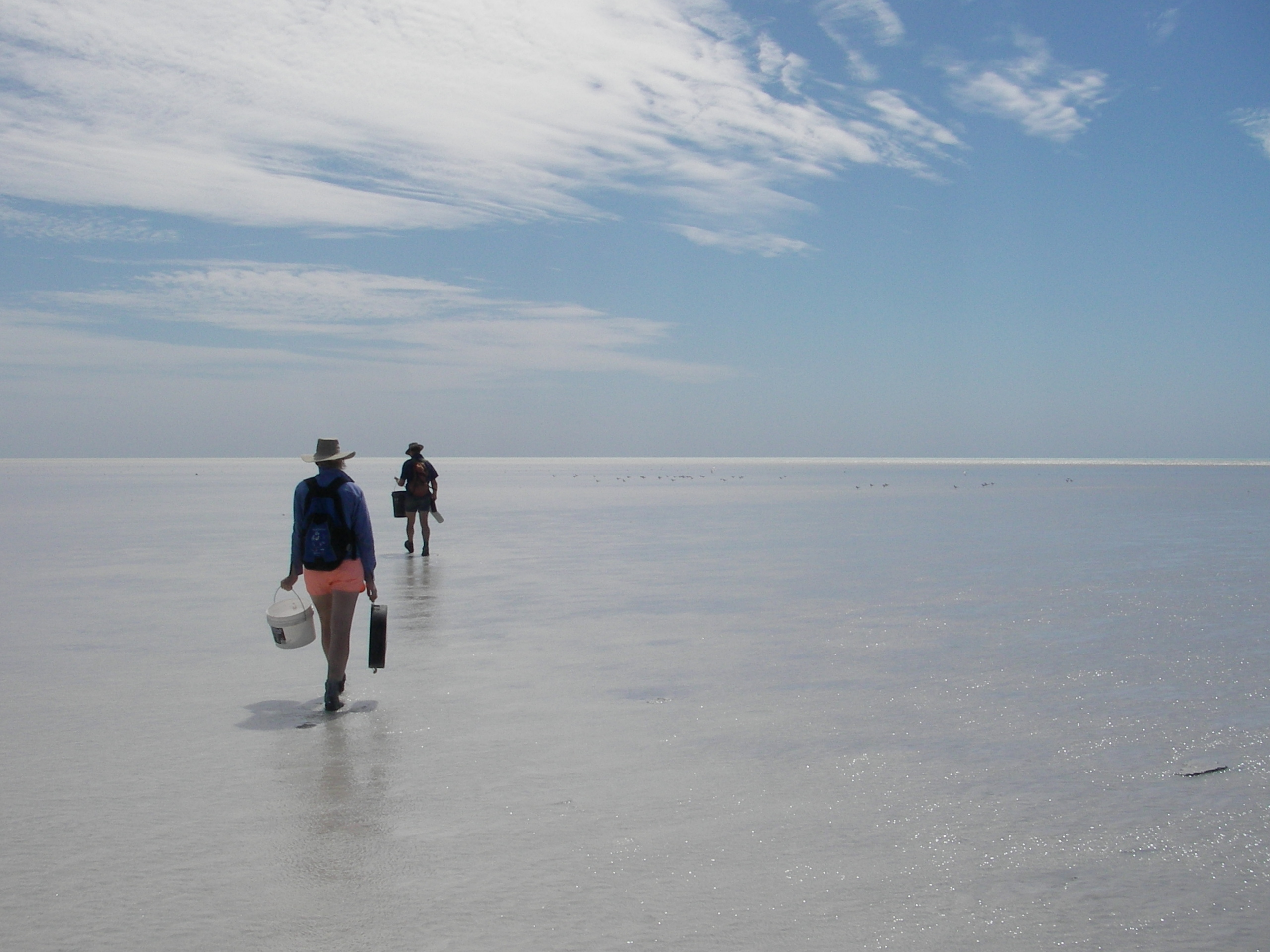 Samplers navigating the sampling grid with a GPS device. Photo: Yvonne Winchcombe[/caption]
This broad pattern was known by 1999, when the first benthic survey was carried out on Eighty Mile Beach. The Annabim-99 expedition surveyed benthos in the tidal flats adjacent to the richest shorebird areas, with samples taken in a grid pattern in blocks spaced at 15 km intervals (with a few opportunistic samples also taken at the Anna Plains access point). In 2016, we sought to repeat this survey and discover if and how benthos abundance, diversity, and distribution changed.
[caption id="attachment_2770" align="alignnone" width="5152"]
Samplers navigating the sampling grid with a GPS device. Photo: Yvonne Winchcombe[/caption]
This broad pattern was known by 1999, when the first benthic survey was carried out on Eighty Mile Beach. The Annabim-99 expedition surveyed benthos in the tidal flats adjacent to the richest shorebird areas, with samples taken in a grid pattern in blocks spaced at 15 km intervals (with a few opportunistic samples also taken at the Anna Plains access point). In 2016, we sought to repeat this survey and discover if and how benthos abundance, diversity, and distribution changed.
[caption id="attachment_2770" align="alignnone" width="5152"]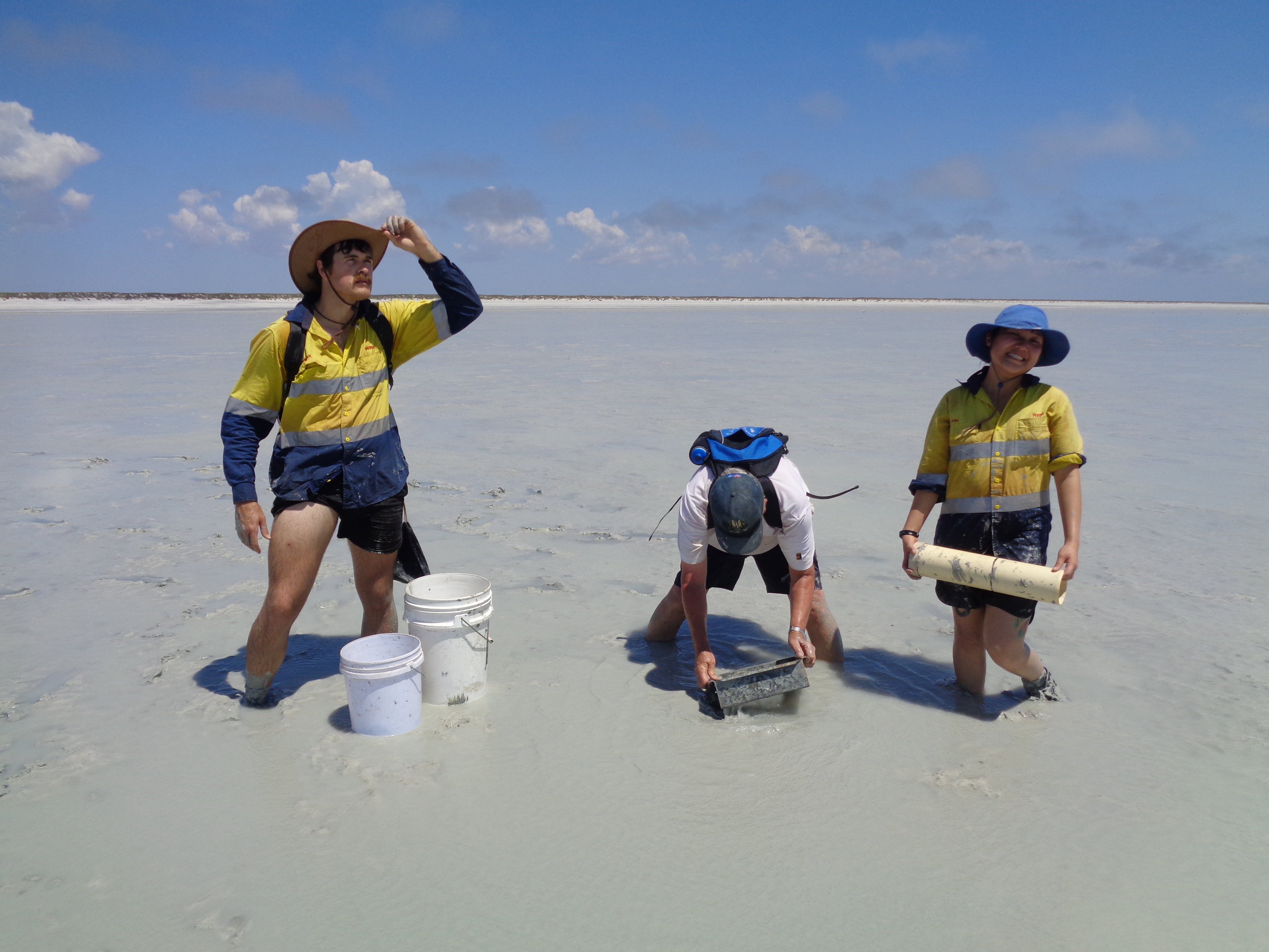 Samplers at Eighty Mile Beach contemplating whether benthos abundance, diversity, and distribution has changed over time. Photo: Marc Lavaleye[/caption]
Information on benthos abundance, diversity, and distribution is essential if we are to conserve the immense and internationally shared natural values of these important shorebird sites and find informed compromises with the increasing use of the foreshore by the ever-increasing human population in the Kimberley Region. A considerable proportion of the world's Great Knots (Calidris tenuirostris) depends on (very specific portions of) Roebuck Bay for moult, survival, and fuelling for migration. This is also true for perhaps all the Red Knots (Calidris canutus piersmai) and Bar-tailed Godwits (Limosa lapponica menzbieri) of specific, reproductively isolated and morphologically and behaviourally distinct subspecies.
[caption id="attachment_2790" align="alignnone" width="5472"]
Samplers at Eighty Mile Beach contemplating whether benthos abundance, diversity, and distribution has changed over time. Photo: Marc Lavaleye[/caption]
Information on benthos abundance, diversity, and distribution is essential if we are to conserve the immense and internationally shared natural values of these important shorebird sites and find informed compromises with the increasing use of the foreshore by the ever-increasing human population in the Kimberley Region. A considerable proportion of the world's Great Knots (Calidris tenuirostris) depends on (very specific portions of) Roebuck Bay for moult, survival, and fuelling for migration. This is also true for perhaps all the Red Knots (Calidris canutus piersmai) and Bar-tailed Godwits (Limosa lapponica menzbieri) of specific, reproductively isolated and morphologically and behaviourally distinct subspecies.
[caption id="attachment_2790" align="alignnone" width="5472"]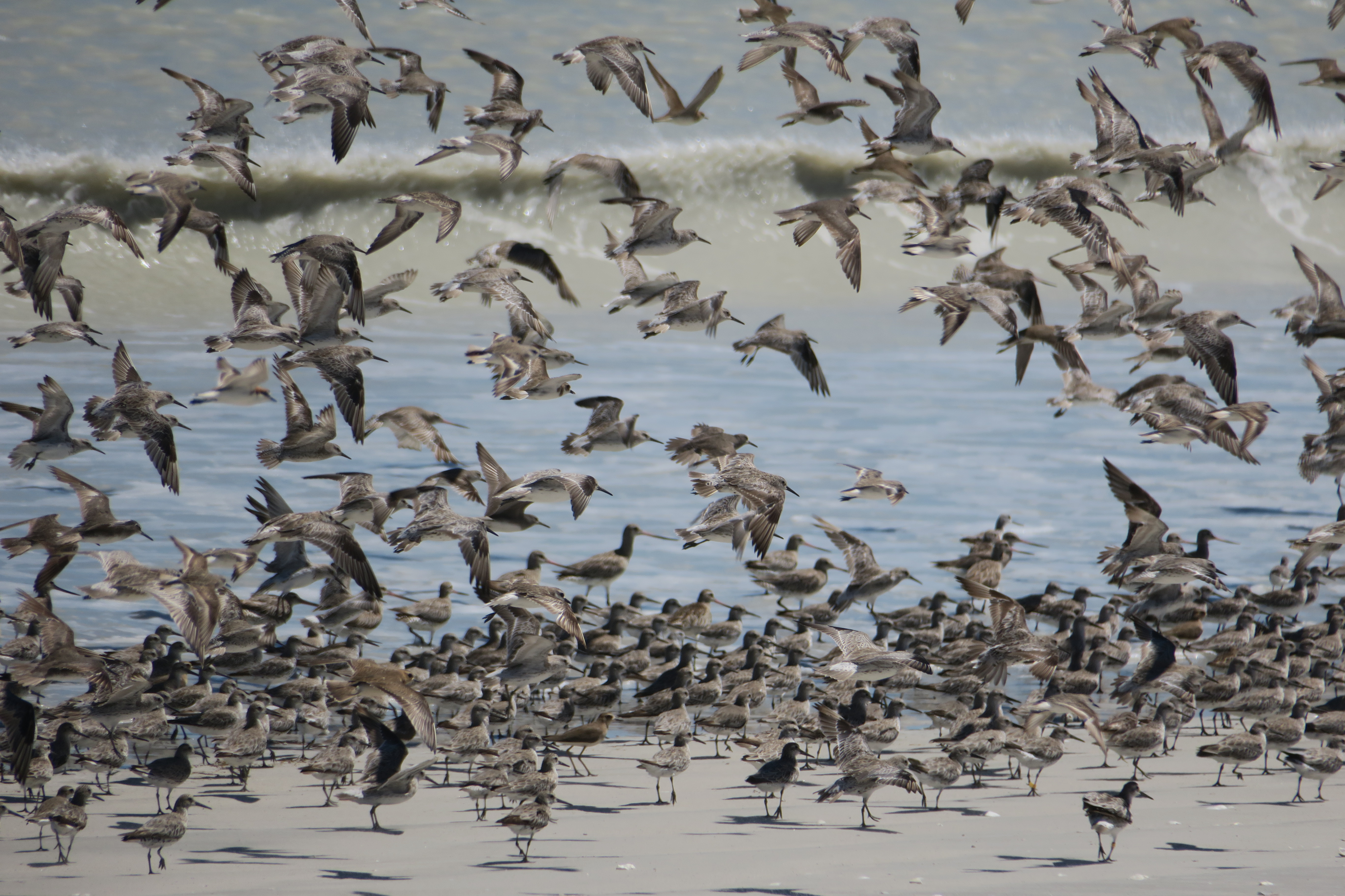 A mixed flock of shorebirds, containing Bar-tailed Godwits and Great Knots. Photo: Ginny Chan[/caption]
The most recent projects builds on the logistical methods and the techniques developed and used so successfully during previous expeditions to Roebuck Bay and Eighty Mile Beach:
A mixed flock of shorebirds, containing Bar-tailed Godwits and Great Knots. Photo: Ginny Chan[/caption]
The most recent projects builds on the logistical methods and the techniques developed and used so successfully during previous expeditions to Roebuck Bay and Eighty Mile Beach:
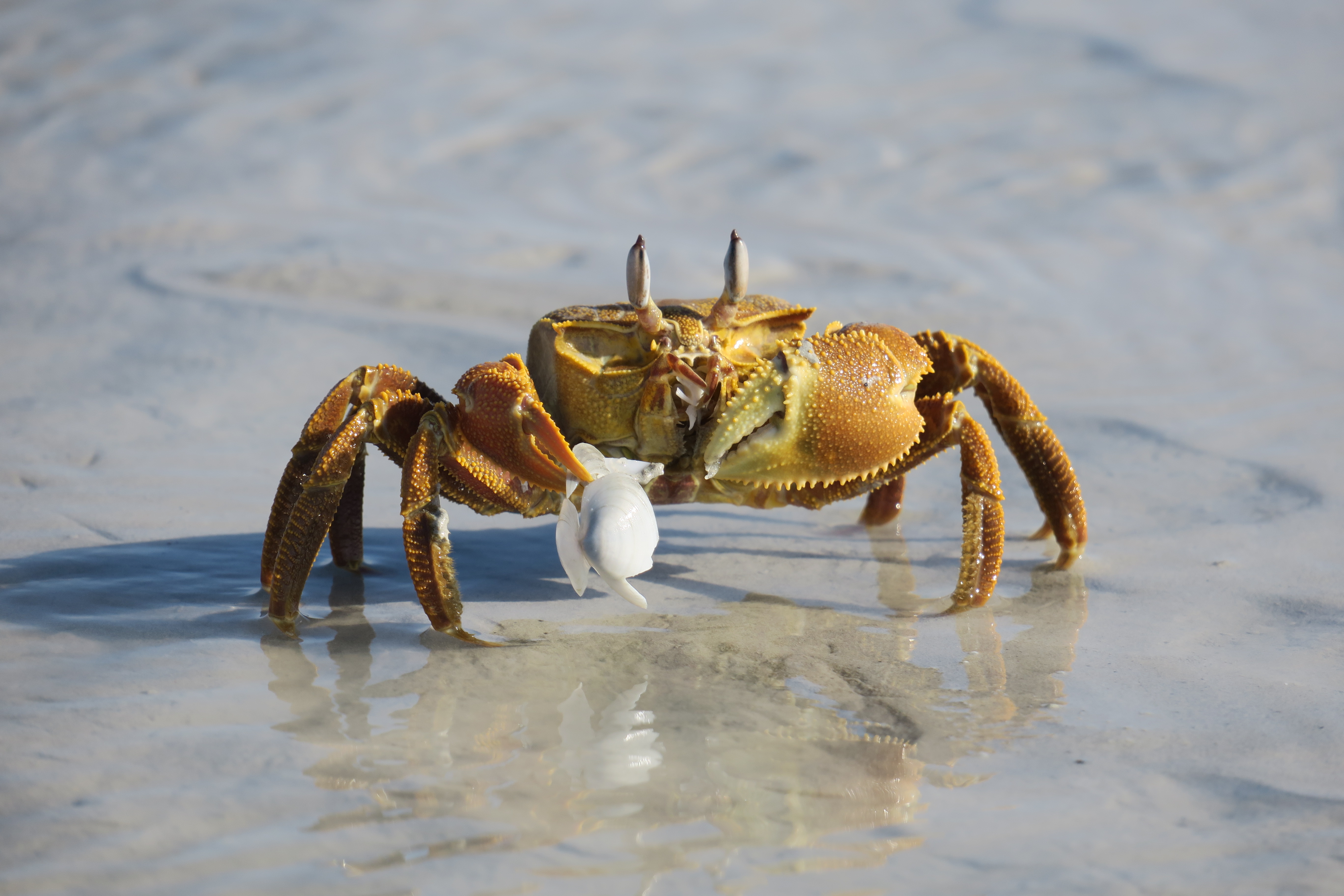 Unexpected help? Photo: Ginny Chan[/caption]
We identify all animal groups up to the level of species if possible, all on the basis of morphological differences. These species were often given field names, as time and means (no literature or internet) did not allow to always attach a proper scientific name. In a few instances we might have pooled species, e.g. in the case of Macrophthalmus, of which we encountered mainly juveniles which are difficult or impossible to identify to species.
It is very likely that some of the species are still undescribed. Animals are preserved on ethanol for a more thorough scientific identification on a later date. We found representatives of many phyla, including Cnidaria (Anthozoa, Pennatulacea), Platyhelminthes, Nemertea, Annelida (Polychaeta, Oligochaeta, Hirudinea), Mollusca (Bivalvia, Gastropoda, Scaphopoda), Crustacea (Brachyura, Anomura, Stomatopoda, Caridea, Isopoda Mysida, Amphipoda, Tanaidacea, Ostracoda, Copepoda), Sipuncula, Echiura, Phoronida, Echinodermata (Ophiuroidea, Asteroidea, Holothuroidea, Crinoidea, Echinoidea), Tunicata, Enteropneusta and fish.
[caption id="attachment_2829" align="alignnone" width="4032"]
Unexpected help? Photo: Ginny Chan[/caption]
We identify all animal groups up to the level of species if possible, all on the basis of morphological differences. These species were often given field names, as time and means (no literature or internet) did not allow to always attach a proper scientific name. In a few instances we might have pooled species, e.g. in the case of Macrophthalmus, of which we encountered mainly juveniles which are difficult or impossible to identify to species.
It is very likely that some of the species are still undescribed. Animals are preserved on ethanol for a more thorough scientific identification on a later date. We found representatives of many phyla, including Cnidaria (Anthozoa, Pennatulacea), Platyhelminthes, Nemertea, Annelida (Polychaeta, Oligochaeta, Hirudinea), Mollusca (Bivalvia, Gastropoda, Scaphopoda), Crustacea (Brachyura, Anomura, Stomatopoda, Caridea, Isopoda Mysida, Amphipoda, Tanaidacea, Ostracoda, Copepoda), Sipuncula, Echiura, Phoronida, Echinodermata (Ophiuroidea, Asteroidea, Holothuroidea, Crinoidea, Echinoidea), Tunicata, Enteropneusta and fish.
[caption id="attachment_2829" align="alignnone" width="4032"]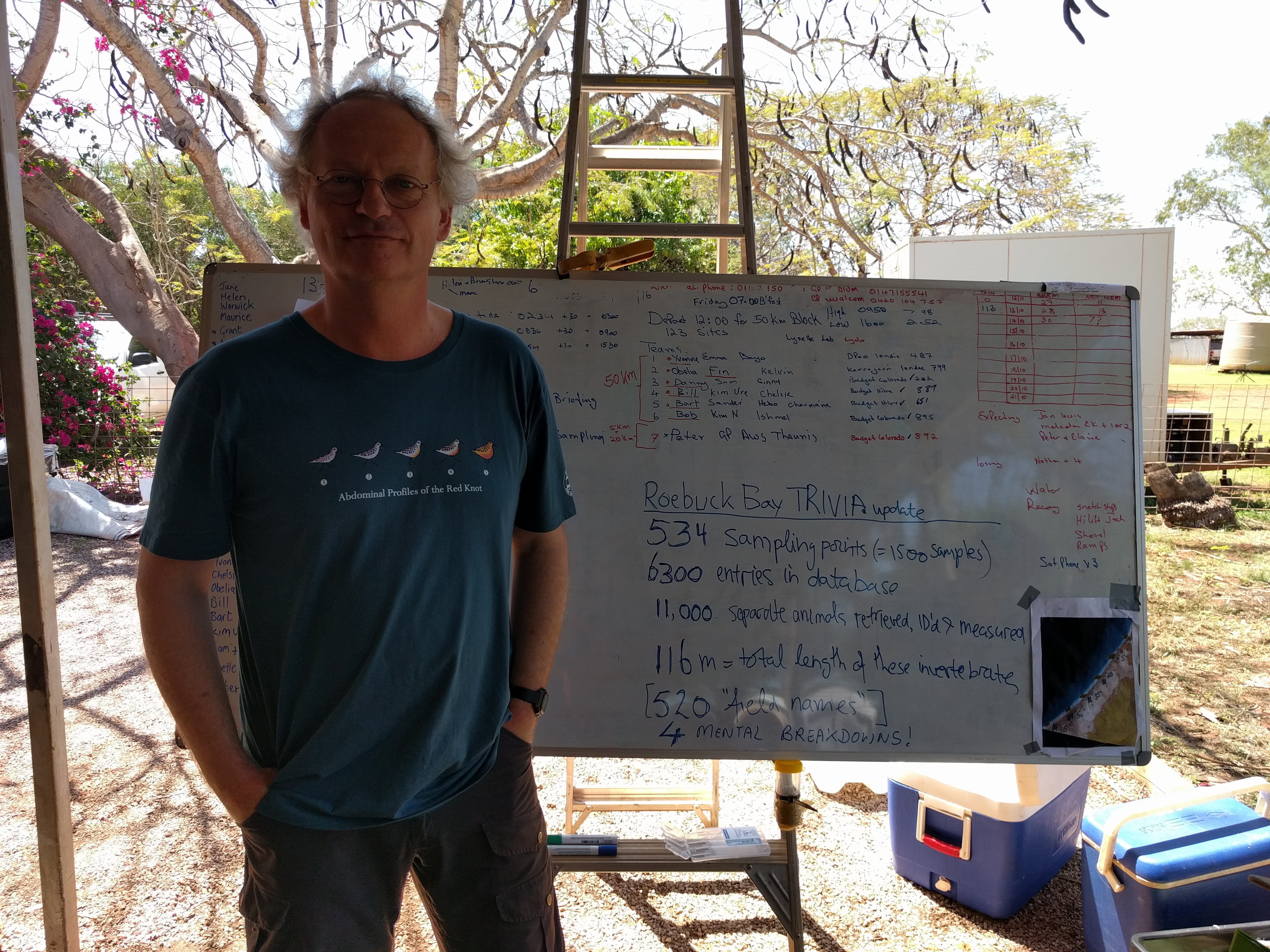 Theunis Piersma summing up state of sampling (and mind). Anna Plains, October 2016. Photo: Bob Hickey[/caption]
[caption id="attachment_2811" align="alignnone" width="4608"]
Theunis Piersma summing up state of sampling (and mind). Anna Plains, October 2016. Photo: Bob Hickey[/caption]
[caption id="attachment_2811" align="alignnone" width="4608"]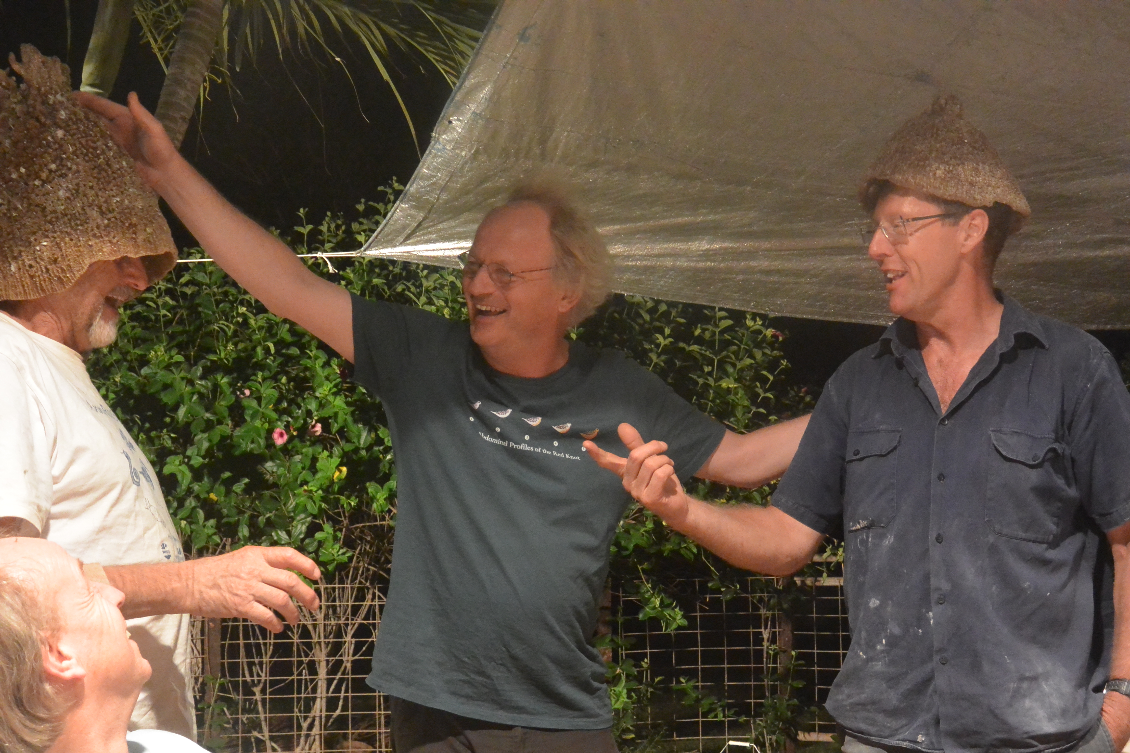 Danny Rogers, Grant Pearson,Theunis Piersma and Andrew Storey. Photo: Ginny Chan[/caption]
References:
Pepping, M., T. Piersma, G.B. Pearson & M. Lavaleye (eds.) 1999. Intertidal sediments and benthic animals of Roebuck Bay, Western Australia. NIOZ-report 1999-3, Texel.
Piersma, T., G.B. Pearson, R. Hickey, M. Lavaleye & D. Rogers. 2002. Southern Roebuck Bay Invertebrate and bird Mapping 2002 – SROEBIM-02. Preliminary Research Report. NIOZ, Texel/CALM, Perth.
Piersma, T., G.B. Pearson, R. Hickey & M. Lavaleye (eds.) 2005. The long mud. Benthos and shorebirds of the foreshore of Eighty-mile Beach, Western Australia. NIOZ-report 2005-2, Texel.
Piersma, T., G.B. Pearson, R. Hickey, S. Dittmann, D.I. Rogers, E. Folmer, P. Honkoop, J. Drent, P. de Goeij & L. Marsh. 2006. Roebuck Bay Invertebrate and bird Mapping 2006 – ROEBIM-06. Preliminary Research Report. NIOZ, Texel/CALM, Perth.
Piersma, T., G.B. Pearson, M. Lavaleye, R. Hickey, D.I. Rogers, S. Holthuijsen, S. Marin-Estrella, P. de Goeij, N. Findlay & A.W. Storey. 2016. Anna Plains and Roebuck Bay Invertebrate Mapping 2016 – AnnRoenBIM-16. Field Report. Department of Parks and Wildlife, Broome / NIOZ, Texel / Wetland Research & Management, Burswood
Rogers, D., P. Battley & T. Piersma. 2000. Tracking 2000: Radio-telemetry and other studies of Great Knots and Red Knots in Roebuck Bay, March-April 2000. Progress Report. NIOZ, Texel.
Rogers, D.I., T. Piersma, M. Lavaleye, G.B. Pearson, P. de Goeij & J. van de Kam. 2003. Life along land’s edge. Wildlife on the shores of Roebuck Bay, Broome. Department of Conservation and Land Management, Perth.
Further reading and reference can be found at the Roebuck Bay Working Group Inc.
[caption id="attachment_2842" align="alignnone" width="4608"]
Danny Rogers, Grant Pearson,Theunis Piersma and Andrew Storey. Photo: Ginny Chan[/caption]
References:
Pepping, M., T. Piersma, G.B. Pearson & M. Lavaleye (eds.) 1999. Intertidal sediments and benthic animals of Roebuck Bay, Western Australia. NIOZ-report 1999-3, Texel.
Piersma, T., G.B. Pearson, R. Hickey, M. Lavaleye & D. Rogers. 2002. Southern Roebuck Bay Invertebrate and bird Mapping 2002 – SROEBIM-02. Preliminary Research Report. NIOZ, Texel/CALM, Perth.
Piersma, T., G.B. Pearson, R. Hickey & M. Lavaleye (eds.) 2005. The long mud. Benthos and shorebirds of the foreshore of Eighty-mile Beach, Western Australia. NIOZ-report 2005-2, Texel.
Piersma, T., G.B. Pearson, R. Hickey, S. Dittmann, D.I. Rogers, E. Folmer, P. Honkoop, J. Drent, P. de Goeij & L. Marsh. 2006. Roebuck Bay Invertebrate and bird Mapping 2006 – ROEBIM-06. Preliminary Research Report. NIOZ, Texel/CALM, Perth.
Piersma, T., G.B. Pearson, M. Lavaleye, R. Hickey, D.I. Rogers, S. Holthuijsen, S. Marin-Estrella, P. de Goeij, N. Findlay & A.W. Storey. 2016. Anna Plains and Roebuck Bay Invertebrate Mapping 2016 – AnnRoenBIM-16. Field Report. Department of Parks and Wildlife, Broome / NIOZ, Texel / Wetland Research & Management, Burswood
Rogers, D., P. Battley & T. Piersma. 2000. Tracking 2000: Radio-telemetry and other studies of Great Knots and Red Knots in Roebuck Bay, March-April 2000. Progress Report. NIOZ, Texel.
Rogers, D.I., T. Piersma, M. Lavaleye, G.B. Pearson, P. de Goeij & J. van de Kam. 2003. Life along land’s edge. Wildlife on the shores of Roebuck Bay, Broome. Department of Conservation and Land Management, Perth.
Further reading and reference can be found at the Roebuck Bay Working Group Inc.
[caption id="attachment_2842" align="alignnone" width="4608"]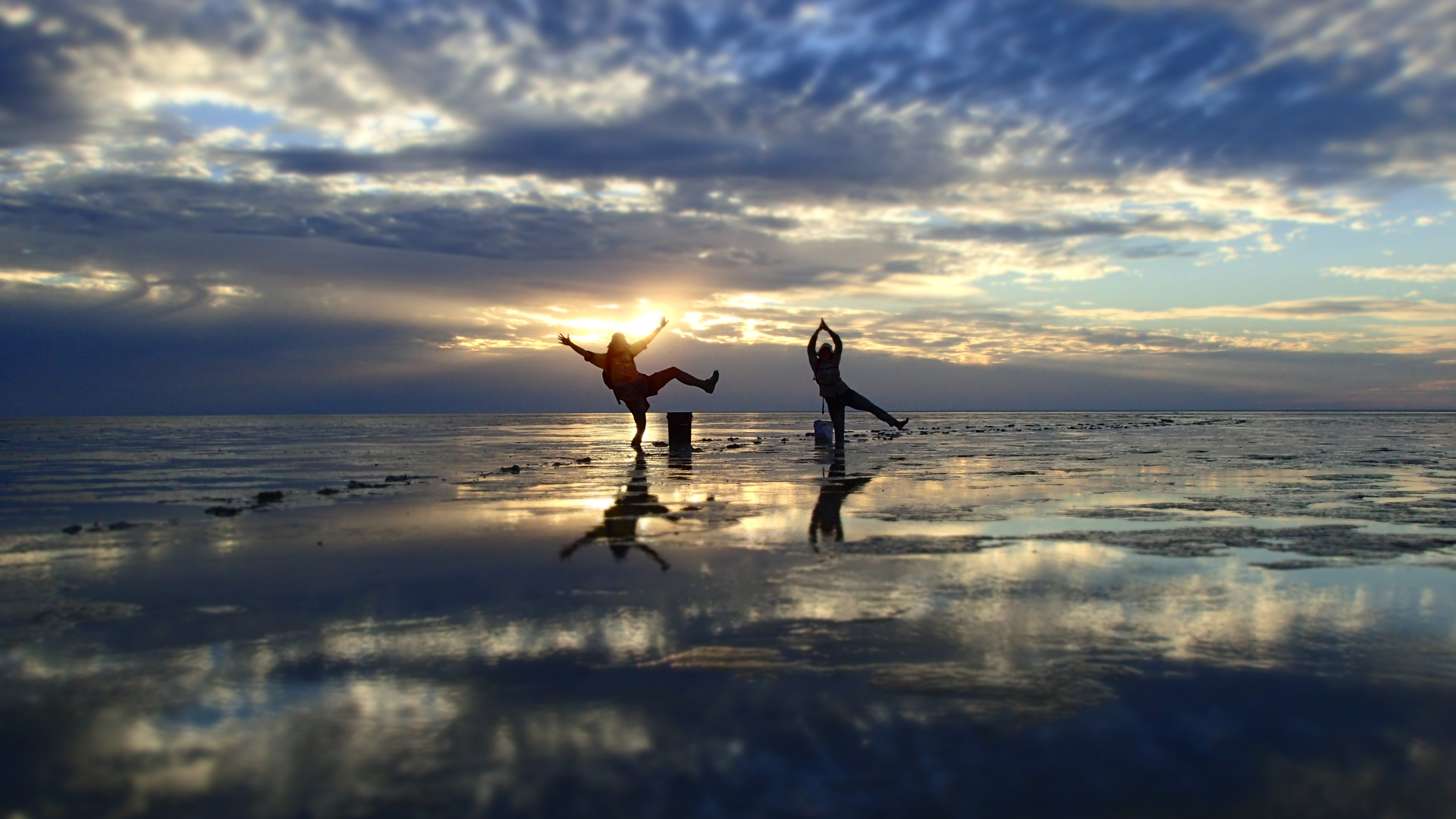 Done. Photo: He-bo Peng[/caption]
Grant Pearson, coordinator of Anna Plains and Roebuck Bay Benthic Invertebrate Mapping (AnnRoeBIM) and part of his team at Eighty Mile Beach. Photo: Grant Pearson[/caption]
Why are close to 100 participants (mostly volunteers) motivated to dig up, sieve, and sort the mud samples in the tropical heat?
Eighty Mile Beach and Roebuck Bay are world-renowned as non-breeding sites for migratory shorebirds (Rogers et al. 2003). These small to medium-sized birds – sandpipers, plovers, curlews, knots, and the like – nest in the far northern hemisphere in habitats ranging from Mongolian steppes to high arctic tundra. In the non-breeding season, they inhabit a very different world, depending on intertidal mudflats where they feed on benthic invertebrates. The rich and diverse benthos of the extensive intertidal flats in northwest Australia support a large and uniquely diverse migratory shorebird community. [caption id="attachment_2744" align="alignnone" width="2560"] (Happy) samplers returning from in Roebuck Bay. Photo: Yvonne Winchcombe[/caption]
Hundreds of thousands of migratory shorebirds rely on Roebuck Bay and Eighty Mile Beach for their non-breeding survival and preparation for northward migration. Indeed, there are few places on earth where intertidal mudflats support larger numbers of migratory shorebirds.
[caption id="attachment_2751" align="alignnone" width="2048"] Roebuck Bay, Broome. Western Australia[/caption]
Roebuck Bay is one of fewer than twenty comparable coastal areas scattered around the globe. The features that characterise this Bay and make it so outstanding are varied and complex have also been the subject of considerable scientific and community investigation over the past 20 years. This unusual collaboration between science and community has been the catalyst for ours effort to map the nature and distribution of the sediments of Roebuck Bay and Eighty Mile Beach.
[caption id="attachment_2762" align="alignnone" width="1024"] Eighty Mile Beach. Photo: Jan van de Kam[/caption]
Shorebirds have been surveyed a number of times since Eighty Mile Beach was ‘discovered’ by shorebird biologists in 1981, and some variably complete shorebird counts were carried out in the early 1980’s by a combination of aerial survey and localised ground counts. The first complete ground-based summer count of the shorebirds was carried out in 1999. Subsequent surveys confirmed the great importance of Eighty Mile Beach to shorebirds and revealed that most species are quite consistent in their distribution on the beach, with many species occurring in highest numbers in the section between 0 and 65 km south of the Anna Plains access point.
[caption id="attachment_2797" align="alignnone" width="2560"] Samplers navigating the sampling grid with a GPS device. Photo: Yvonne Winchcombe[/caption]
This broad pattern was known by 1999, when the first benthic survey was carried out on Eighty Mile Beach. The Annabim-99 expedition surveyed benthos in the tidal flats adjacent to the richest shorebird areas, with samples taken in a grid pattern in blocks spaced at 15 km intervals (with a few opportunistic samples also taken at the Anna Plains access point). In 2016, we sought to repeat this survey and discover if and how benthos abundance, diversity, and distribution changed.
[caption id="attachment_2770" align="alignnone" width="5152"] Samplers at Eighty Mile Beach contemplating whether benthos abundance, diversity, and distribution has changed over time. Photo: Marc Lavaleye[/caption]
Information on benthos abundance, diversity, and distribution is essential if we are to conserve the immense and internationally shared natural values of these important shorebird sites and find informed compromises with the increasing use of the foreshore by the ever-increasing human population in the Kimberley Region. A considerable proportion of the world's Great Knots (Calidris tenuirostris) depends on (very specific portions of) Roebuck Bay for moult, survival, and fuelling for migration. This is also true for perhaps all the Red Knots (Calidris canutus piersmai) and Bar-tailed Godwits (Limosa lapponica menzbieri) of specific, reproductively isolated and morphologically and behaviourally distinct subspecies.
[caption id="attachment_2790" align="alignnone" width="5472"] A mixed flock of shorebirds, containing Bar-tailed Godwits and Great Knots. Photo: Ginny Chan[/caption]
The most recent projects builds on the logistical methods and the techniques developed and used so successfully during previous expeditions to Roebuck Bay and Eighty Mile Beach:
- ROEBIM-1997 (Pepping et al. 1999)
- ANNABIM-1999 (Piersma et al. 2005)
- Tracking-2000 (Rogers et al. 2000)
- SROEBIM-2002 (Piersma et al. 2002)
- ROEBIM-2006 (Piersma et al. 2006)
- AnnRoeBIM-2016 (Piersma et al. 2016)
Unexpected help? Photo: Ginny Chan[/caption]
We identify all animal groups up to the level of species if possible, all on the basis of morphological differences. These species were often given field names, as time and means (no literature or internet) did not allow to always attach a proper scientific name. In a few instances we might have pooled species, e.g. in the case of Macrophthalmus, of which we encountered mainly juveniles which are difficult or impossible to identify to species.
It is very likely that some of the species are still undescribed. Animals are preserved on ethanol for a more thorough scientific identification on a later date. We found representatives of many phyla, including Cnidaria (Anthozoa, Pennatulacea), Platyhelminthes, Nemertea, Annelida (Polychaeta, Oligochaeta, Hirudinea), Mollusca (Bivalvia, Gastropoda, Scaphopoda), Crustacea (Brachyura, Anomura, Stomatopoda, Caridea, Isopoda Mysida, Amphipoda, Tanaidacea, Ostracoda, Copepoda), Sipuncula, Echiura, Phoronida, Echinodermata (Ophiuroidea, Asteroidea, Holothuroidea, Crinoidea, Echinoidea), Tunicata, Enteropneusta and fish.
[caption id="attachment_2829" align="alignnone" width="4032"] Theunis Piersma summing up state of sampling (and mind). Anna Plains, October 2016. Photo: Bob Hickey[/caption]
[caption id="attachment_2811" align="alignnone" width="4608"] Danny Rogers, Grant Pearson,Theunis Piersma and Andrew Storey. Photo: Ginny Chan[/caption]
References:
Pepping, M., T. Piersma, G.B. Pearson & M. Lavaleye (eds.) 1999. Intertidal sediments and benthic animals of Roebuck Bay, Western Australia. NIOZ-report 1999-3, Texel.
Piersma, T., G.B. Pearson, R. Hickey, M. Lavaleye & D. Rogers. 2002. Southern Roebuck Bay Invertebrate and bird Mapping 2002 – SROEBIM-02. Preliminary Research Report. NIOZ, Texel/CALM, Perth.
Piersma, T., G.B. Pearson, R. Hickey & M. Lavaleye (eds.) 2005. The long mud. Benthos and shorebirds of the foreshore of Eighty-mile Beach, Western Australia. NIOZ-report 2005-2, Texel.
Piersma, T., G.B. Pearson, R. Hickey, S. Dittmann, D.I. Rogers, E. Folmer, P. Honkoop, J. Drent, P. de Goeij & L. Marsh. 2006. Roebuck Bay Invertebrate and bird Mapping 2006 – ROEBIM-06. Preliminary Research Report. NIOZ, Texel/CALM, Perth.
Piersma, T., G.B. Pearson, M. Lavaleye, R. Hickey, D.I. Rogers, S. Holthuijsen, S. Marin-Estrella, P. de Goeij, N. Findlay & A.W. Storey. 2016. Anna Plains and Roebuck Bay Invertebrate Mapping 2016 – AnnRoenBIM-16. Field Report. Department of Parks and Wildlife, Broome / NIOZ, Texel / Wetland Research & Management, Burswood
Rogers, D., P. Battley & T. Piersma. 2000. Tracking 2000: Radio-telemetry and other studies of Great Knots and Red Knots in Roebuck Bay, March-April 2000. Progress Report. NIOZ, Texel.
Rogers, D.I., T. Piersma, M. Lavaleye, G.B. Pearson, P. de Goeij & J. van de Kam. 2003. Life along land’s edge. Wildlife on the shores of Roebuck Bay, Broome. Department of Conservation and Land Management, Perth.
Further reading and reference can be found at the Roebuck Bay Working Group Inc.
[caption id="attachment_2842" align="alignnone" width="4608"] Done. Photo: He-bo Peng[/caption]